Eshaness - a palimpsest of human activity from prehistory to the present day.
Finding the ‘taskscape’
Friday 5th June.
This walk is a response to a prompt by Caroline Morris to consider Tim Ingold’s notion of ‘taskscape’, and asks the walker to consider signs of activity in the landscape.
“Defined as ‘the pattern of dwelling activities’ , the ‘taskscape’ is the array of practices that human and non‐human beings carry out in the temporal process of inhabiting their environment. The landscape develops concurrently with the taskscape, emerging both socially and ecologically through the ongoing activities that shape the land ... The taskscape emphasises that landscape is not visual scenery to be contemplated or a material backdrop to social life, but a temporal phenomenon entangled with the dwelling of its inhabitants.” in this sense landscape is a palimpsest of human activity from prehistory to the present day.
Ingold draws our attention to the ‘temporality of landscape’, proposing that to enable us to move beyond ‘the naturalistic view of landscape as a neutral external backdrop to human activity’, and a culturalistic view as a ‘symbolic ordering of space’, we should adopt, what he calls a ‘dwelling perspective’, and look at landscape as ‘testimony to the lives and works of past generations of people who have dwelt within it’
In response to this I went to walk with friends in an area called Esha Ness (also written Eshaness), at the top of mainland Shetland (HU 206 785). Eshaness sits on a peninsula on the west coast of North Mavine, a place of massive changes - human and non-human interventions. This is a place that has taken thousands of years in its laying down and will continue to change through the actions of weather and by human and other living forms - plants, animals, whether by involvement through occupation or just passing through. A place that carries layers of time, of occupation and changes.
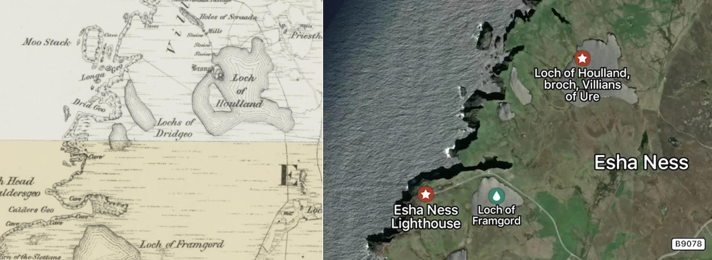
Maps of Eshaness: OS Map 1840s - 1880s. Contemporary map
A long winding road following the contours of the land cuts through fields of grass and heather, populated by sheep, rabbits, birds, and the odd croft, leading up to the head of a peninsula, dominated by the Eshaness Lighthouse, built in 1929 by David and Charles Stevenson (of the Stevenson family of lighthouse engineers, replacing an earlier 1915 one). A bit of research tells me that the original road up to Eshaness was built during the mid-19th century, as a "Meal Road", purely as relief labour. Funded by the Highland Relief Board to combat famine, starving locals paid in oatmeal or flour instead of cash, it would have been made using local unpaved stone, gravel, and earth, as a narrow track for small carts and pack ponies, rather than for modern vehicles. Now metalled, the road ends at a carpark set beside the lighthouse, at the edge of the cliff.
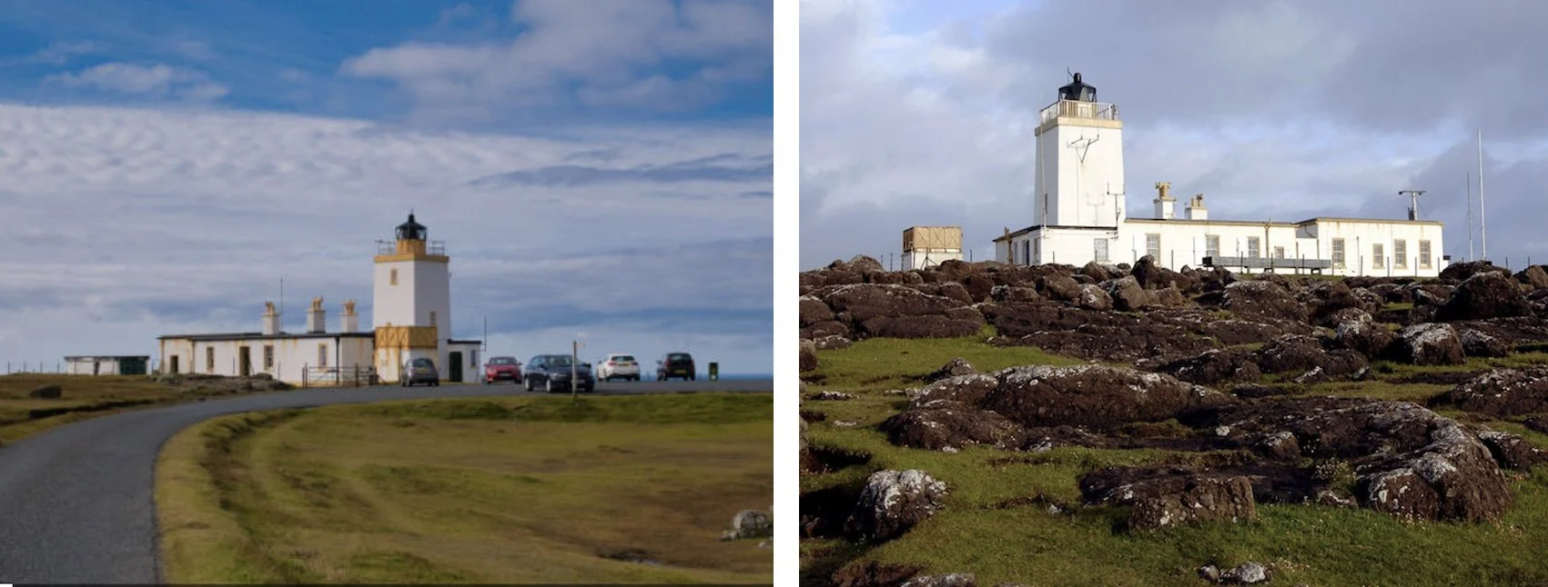
Eshaness Lighthouse
The road is now the access to the place and the ‘experience’, and ending at the lighthouse this as become the focus point for the area. Yet only hundred and fifty years ago the lighthouse wasn’t there, and road would have been rudimentary. So in a way both road and lighthouse engineering where you congregate and what you do.
With a carpark and a bench or two to sit on, the place attracts many visitors and travellers, and today is no exception. The interpretive board notes the geology, other points of interest in the area, and flora and fauna. Engagement takes several forms, people are here in their obligatory waterproofs (you can’t trust Shetland weather), with their long-lens cameras to take their shots of ‘landscape’ or to ‘catch’ that bird as it swoops past or rides the waves in the sea. Some arrive, sit for a while in their cars looking out and then leave, some wander down to the edge of the cliffs, stand and stare down into the sea, others disperse, striding off to walk the headland.
It’s marketed as an impressive place. Visit Shetland’s online guide describes the area as ‘A must-see…. the cliff scenery at Eshaness is truly spectacular with great walks along the coast. Eshaness is also Shetland's volcanic coast with fantastic geology’. Designated as a geo-park, Esha Ness and the surrounding rocks bear the remnants of a ‘stratovolcano’, active around 395 million years ago. The cliffs are built up from volcanic blocks and bombs - agglomerate - lumps of lava and hot rock - thought to have been blasted from a side vent in the Eshaness volcano by explosive eruptions 395 million years ago. Along the coast layers of black and red rock - lava, volcanic ash (tuff) – a build-up of countless lava flows, each surface weathering before the next layer was deposited. Ignimbrite, formed from pyroclastic flow of ash, dust, and lava droplets, cascaded down the side of the volcano, obliterating everything in its path.
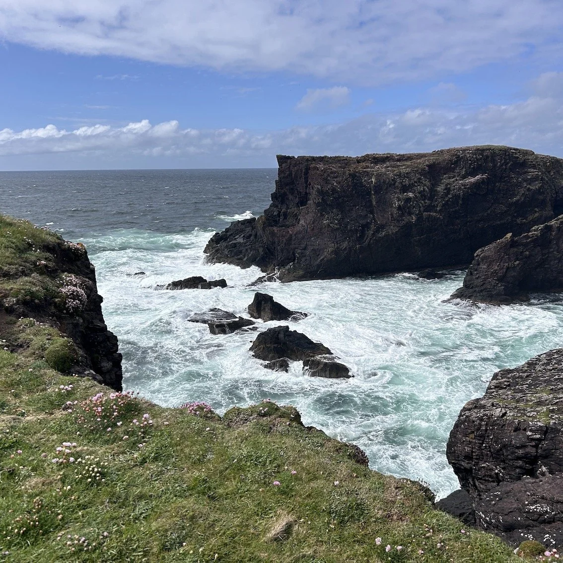
Look closely and you can see orange streaks within the rock - squashed lava droplets. The cliffs continue to weather as the battering of tide and wind slowly erodes the cliffs, carving out dramatic geos (rocky inlets), stacks and blowholes, huge rocks cracking and falling into the sea periodically.
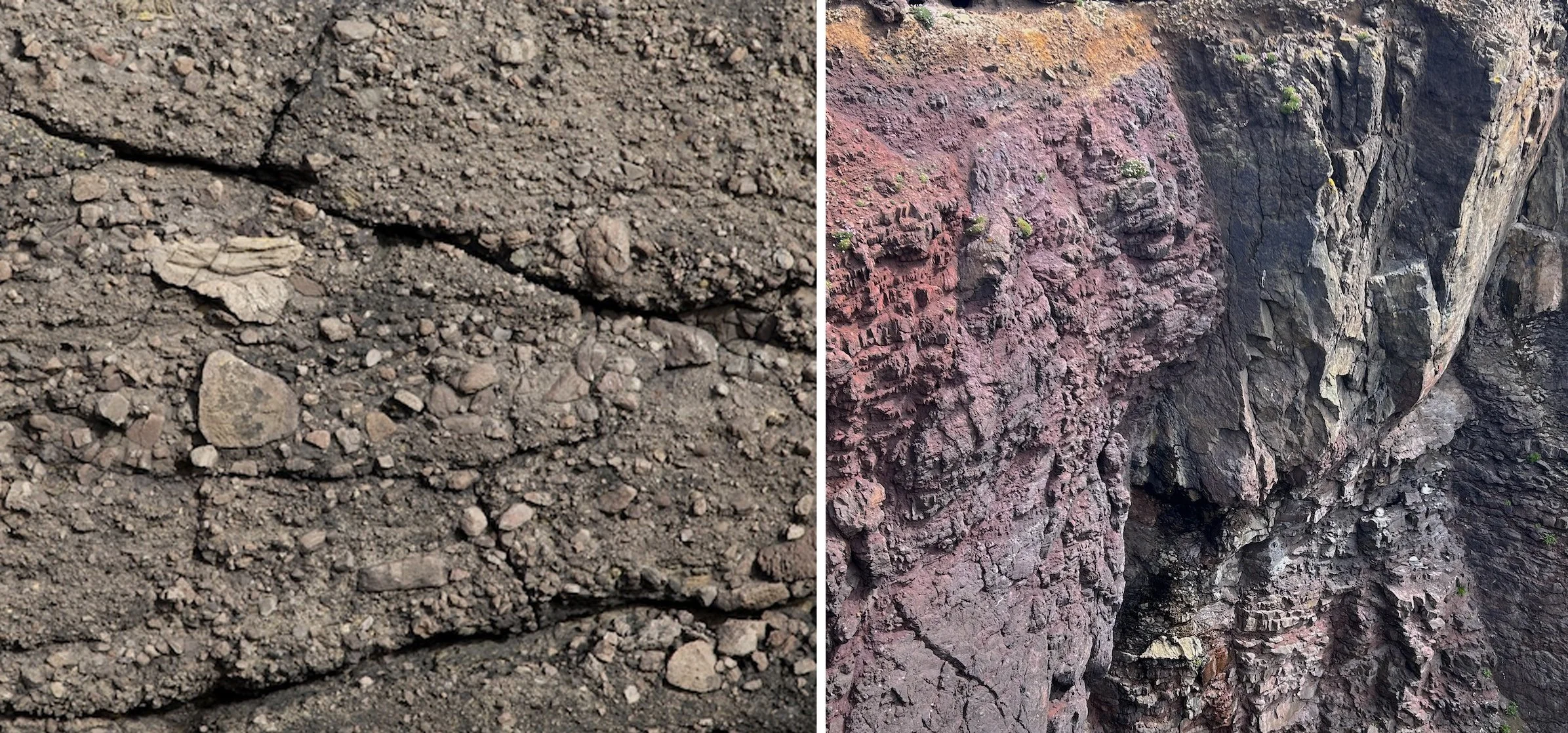
Blocks, and bombs, lava flow and volcanic ash
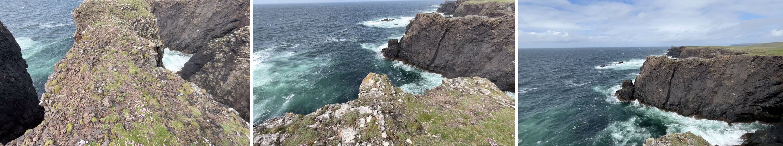
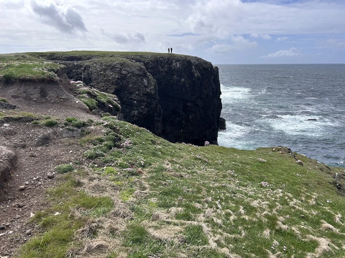
walking out on a narrow pennisula
Peering down I see caves with the sea washing in and out. In a storm, the impact of waves throw rocks high into the air over 15 metres above the sea; although I’ve never actually (and probably fortunately) seen this happen, the evidence lies littering the grass where I walk. There is the constant sound of wind and sea, birds calling.
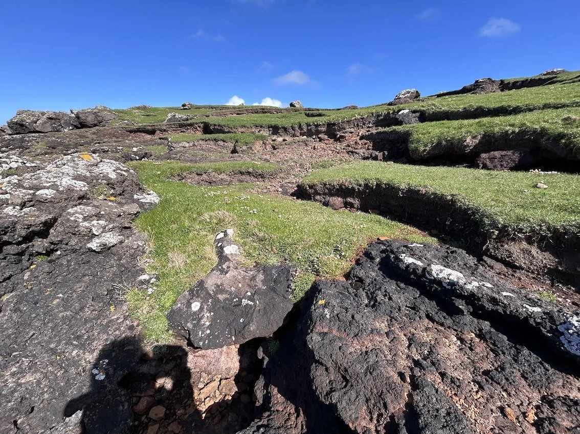
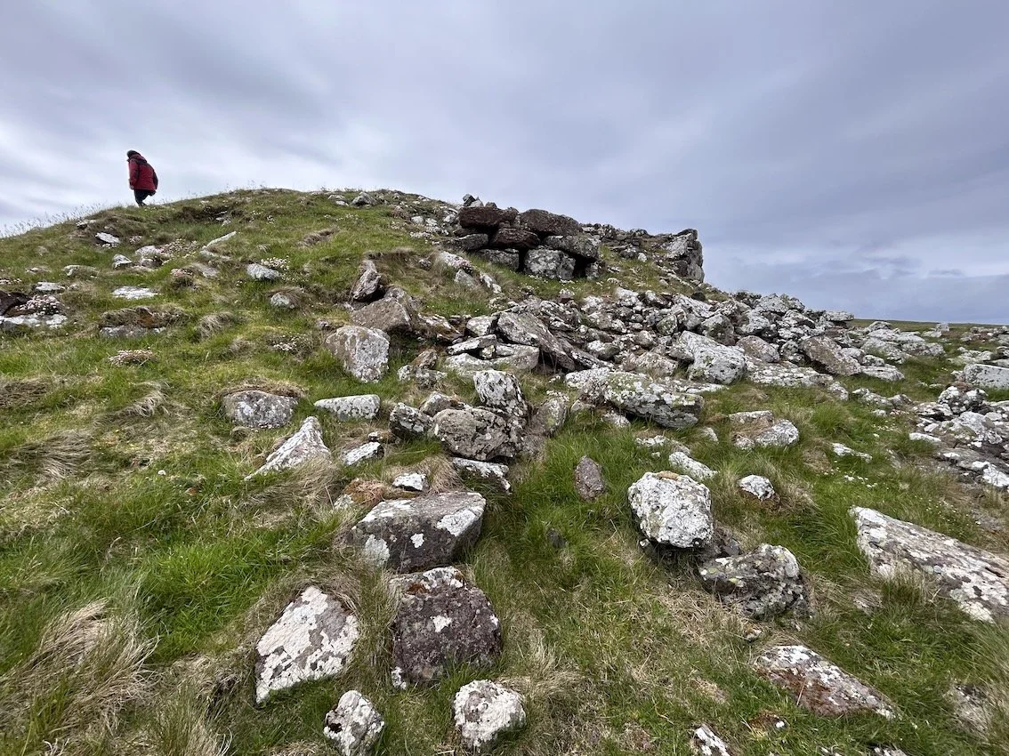
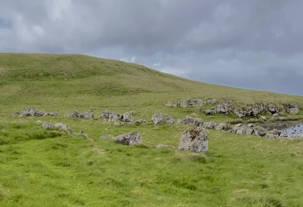
We walk across springy grass, following contours and tracks laid down by the movement of sheep and walkers (Ingold would call this ‘taskscape made visible’), jumping over small streams and avoiding the homes of rabbits, and climbing stiles to reach the remains of a iron-age broch sitting on a large promontory at the edge of the Loch of Houlland.
More human interventions
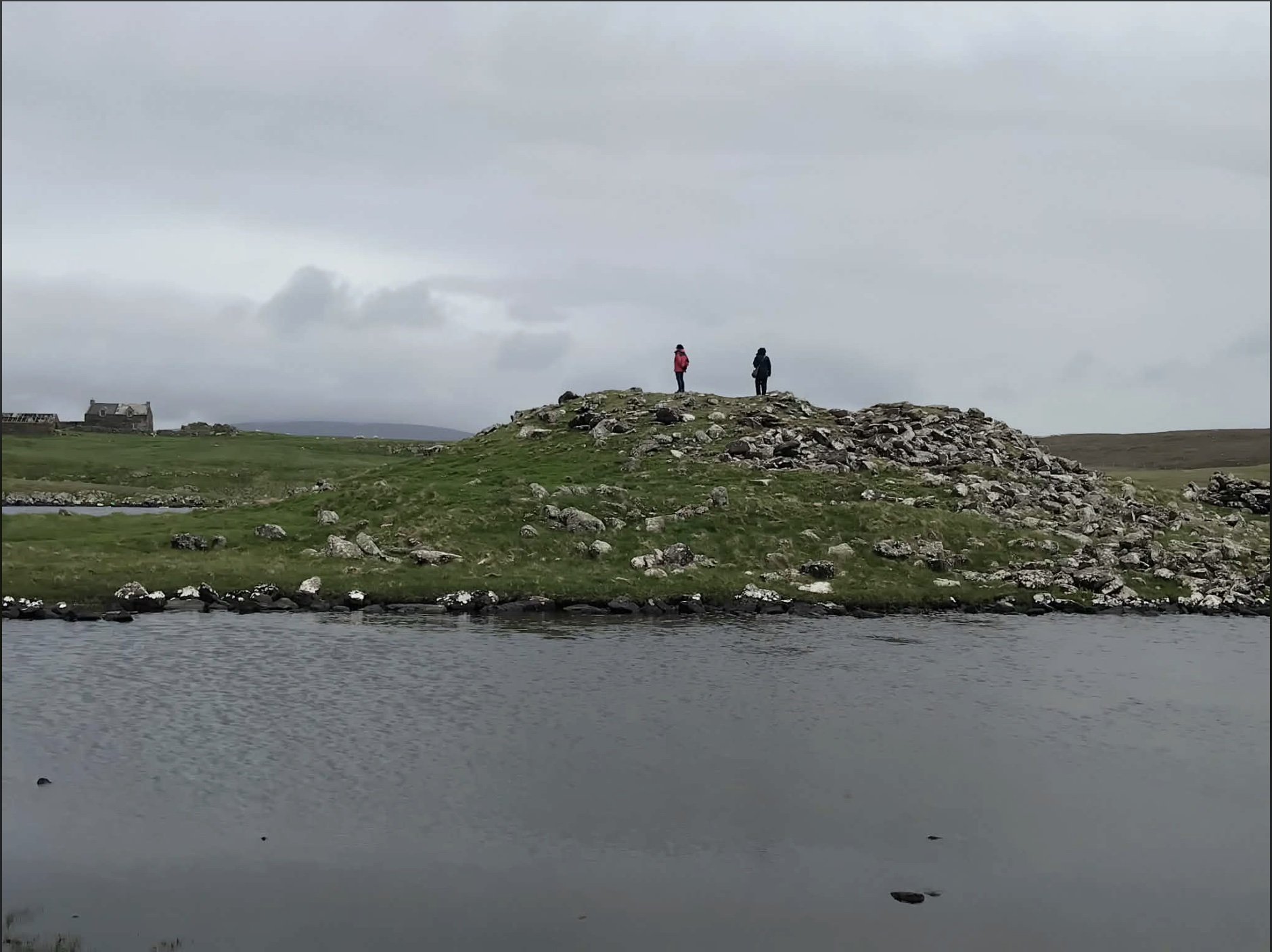
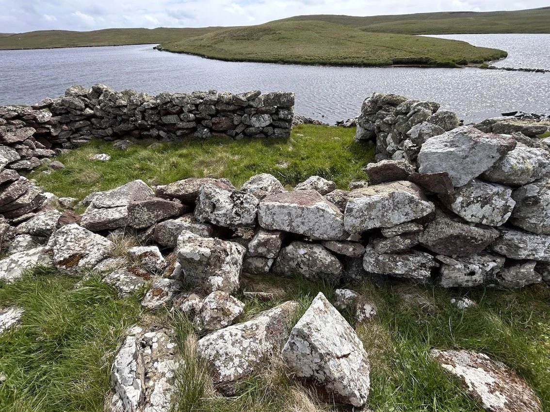
The broch is place that people once gathered, lived and worked; it’s now reduced to its foundations - a tumble of large rocks. Beside the broch a causeway of a narrow line of stones across the loch leads to an island grass mound, I eye this and decide not to try to cross. I’m not sure what the island was used for.
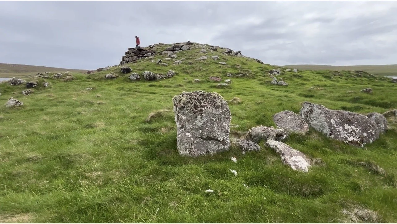
Broch of Houland
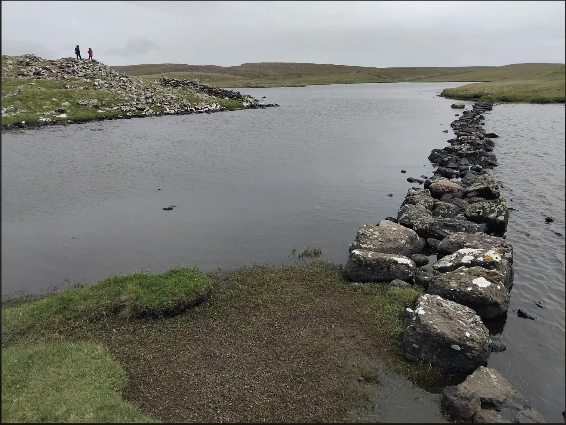
Stone causeway
Prowling around the broch, we climb over precariously-balanced rocks to reach the top, sit and eat sandwiches and contemplate. Grass, moss, and algae have taken over the broch, which apparently had three rows of defensive walls, although it’s difficult to make these out.
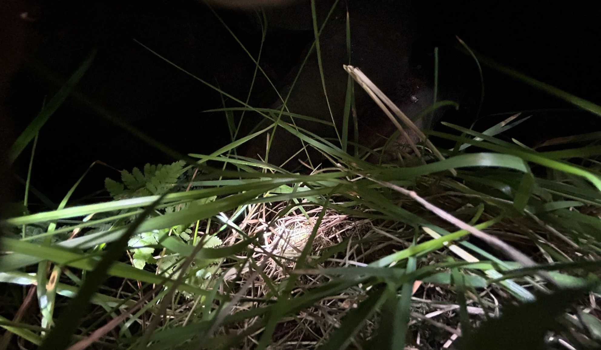
I crouch down to look into the depths and wonder about the people who built and inhabited this place, I reach into the darkness with my camera and photograph – it records a tiny fern growing amongst the grass.
In the scattered stones around the broch I can just about make out several oval and rectangular foundations, (I read that these were built later, maybe by Picts), probably using stones plundered from the broch’s original walls. And there are more contemporary walls built just beside the broch, seem also to have been constructed from repurposed stones.
Across the fields, beyond the broch, sits another human intervention - an old crofthouse, probably built a couple of hundred years ago, and quite possibly using stones from the broch; a place indicating more recent human occupation in the landscape, which would have brought its own sounds and activities. It too is now looking pretty abandoned, slowly degrading - since we first visited 15 years ago, the roofs have fallen in on several of the buildings.
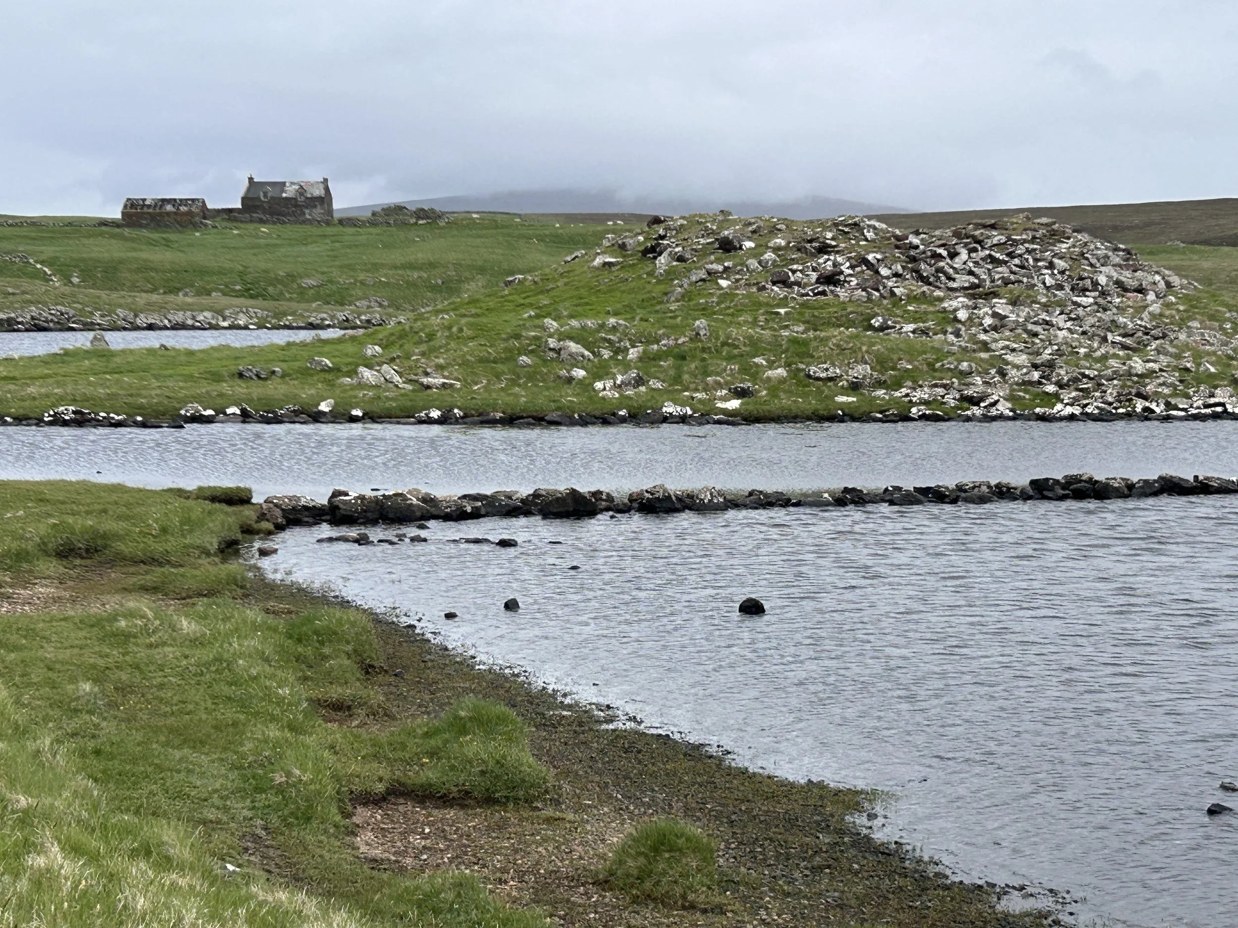
Causeway, broch, and farmhouse
Nearby, a set of three rather dilapidated lichen-covered stone-built Norse click mills sit close to the loch and prehistoric broch, still retaining something of their original structures. Indication of more human production and consumption.
We’re going back and forward in time layers of human activity.
The presence of the mills imply there would have been a track to access and work them, although where people lived is another question. But without the contemporary road and lighthouse the focus of the area would have significantly different.
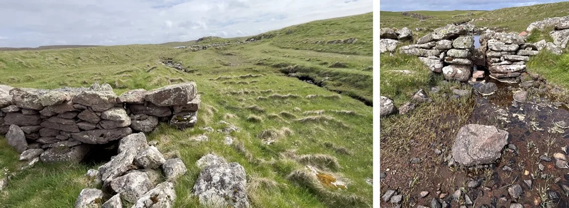
Norse click mills
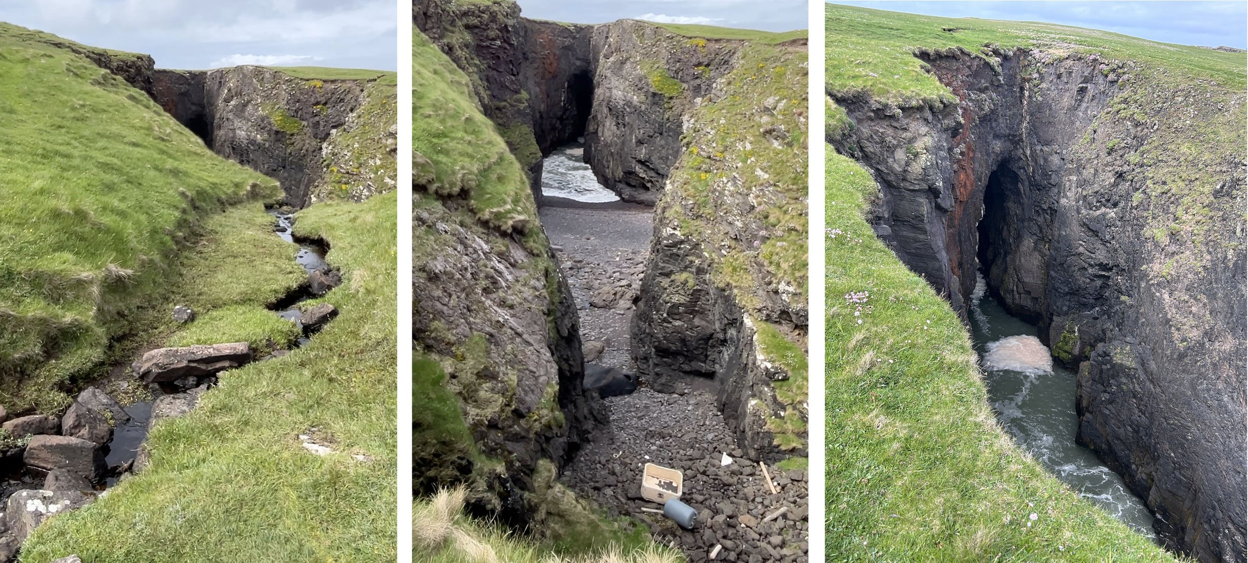
Narrow channels cut into the earth divert water from a burn through each mill, which, following it, empties into the Holes of Scraada - where the roof of a deep cavern has collapsed and now resonates with the noise of the crashing sea. This long underground tunnel, carved by the sea, leads from the cliffs to emerge about 100 yards inland. Peering into the vast hole I watch the sea washing in and out, there’s a strong smell of seaweed, fulmars nesting on the cliffs wheeling around below me, and human detritus lies on its shore.
Back to the cliffs and sea – I can’t resist the pull of the waves surging and breaking on the rocks far below me. I find a space amongst the rocks as close to the edge and as out of view of people as I can be, and sit and draw – to engage with the world through paper and graphite - and catch my waves, to hear, feel, and smell the sea and wind.
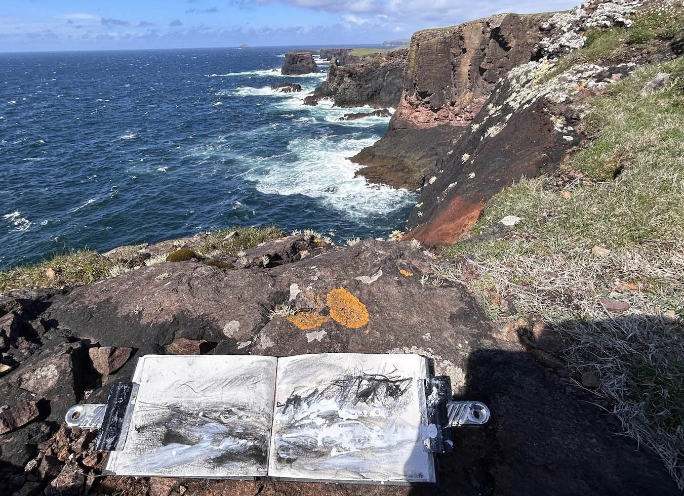
sketchbook - drawing in progress
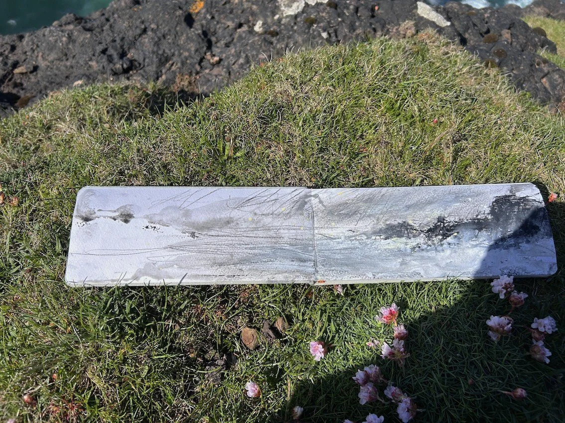
sketchbook drawing
This is a place that I return to time and time again, my own attentive engagement filling me - a ‘homeland’ (term borrowed from Merleau-Ponty in Phenomenology of Perception, 1962) for my thoughts and imagination.
Eshaness is a co-constructed place. I return to Ingold:
‘Life is lived in a zone in which earthly substances and aerial media are brought together in the constitution of beings which, in their activity, participate in weaving the textures of the land. Here, organisms figure not as externally bounded entities but as bundles of interwoven lines of growth and movement, together constituting a meshwork in fluid space. The environment, then, comprises not the surroundings of the organism but a zone of entanglement’.
Bindings against Boundaries: Entanglements of Life in an Open World. Tim Ingold, 2008.
Thanks to Steve Poole and Linda Wigley for accompanying me on the walk