Deep Encounters is a proposed project involving 14 artists working in different areas/locations.
We have applied for funding from the Landscape Research Group and await response.
Set up in conjunction with Walking the Land https://walkingtheland.org.uk/deep-encounters/
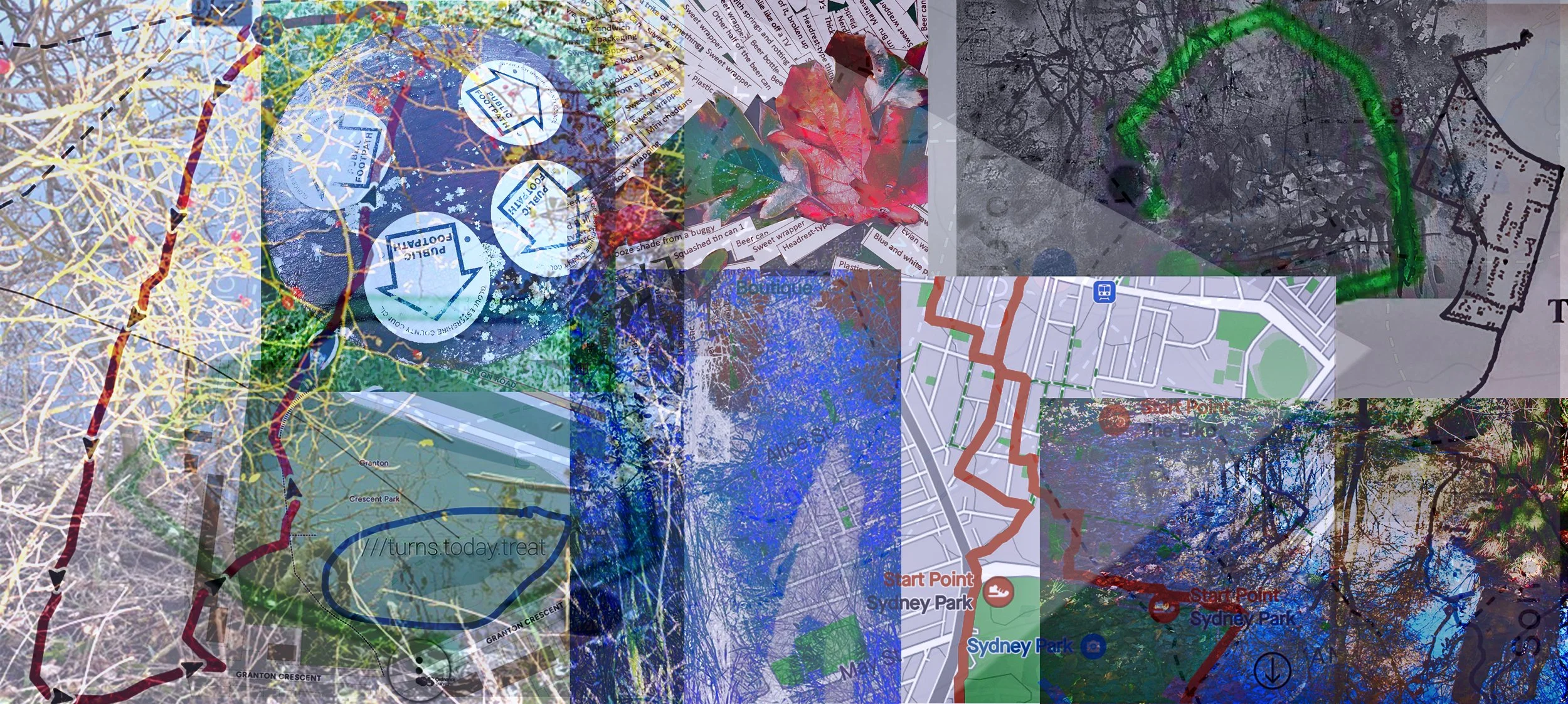
Working collaboratively, but from different parts of the world, it is planned to hold periodic conversations about how we are each representing our piece of land, and ideas for shared activities. Identifying their area of study via Google mapping / OS map / w3ws, each artist will walk the perimeter of their area, tracing the outline, recording what it contains using photos, words, drawings, maps, sound etc. Walking our chosen places, getting to know them, activities and engagements will develop gradually from a growing familiarity. And we will be playful in our responses!
Participating artists:
Zoe Ashbrook , Ruth Broadbent, Alison Berrett, Sara Dudman, Ffin(vc Price), Tamsin Grainger, Richard Keating, Melinda Hunt, Janette Kerr, Rachel McDonnell, Amanda Steer, Sally Stenton, Amanda Steer, Molly Wagner, Marelen Creates.
This is an exercise in deep mapping; an intensive look at a particular place that might include geography, history, and ecology. Some call the approach ‘vertical travel writing’, while archaeologist Michael Shanks compares it to the eclectic approaches of 18th-early 19th century antiquarian topographers, or the psycho-geographic excursions of the early Situationists.
‘…..Places are not stable; they mean different things to different people – even different things at different times. The deep map recognises the slippery identity of place, and seeks to visualise the multiple identities that go towards constructing the human experience of place'.
https://wp.lancs.ac.uk/lakesdeepmap/the-project/gis-deep-mapping/
We increasingly need to work in “the curious space between wonder and thought” a space where….“there is no single Disciplinary (in an academic sense) voice” (geographers Stephan Harrison, Steve Pile, Nigel Thrift), …. the: “space–betweenrepresentation and reality, language and life, category and experience” (feminist philosopher Geraldine Finn).. (see https://www.iainbiggs.co.uk/2014/10/deep-mapping-a-partial-view/)
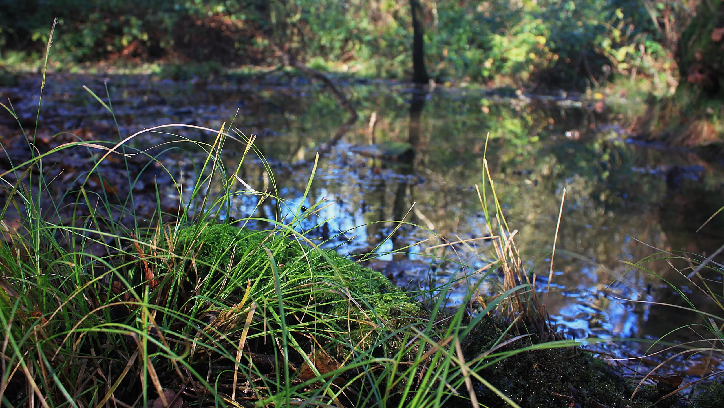
A year long study of a small pond in Coal Barton Wood, Coleford, Somerset
w3w: novelists//elbow//searching (Taken from the tree growing in the middle of the pond)
Coal Barton Wood, Coleford. Drop downhill into a valley and there’s a small wood with a tiny stream running through it. Hidden amongst the trees lies an inconspicuous pond, surrounded by brambles and saplings. A trickle of water feeding it can just be seen under the foliage. I’ve chosen this place because it’s somewhere little visited; unnoticed. It has its own boundaries of raised banks enclosing it; walking around it takes less than 5 minutes, despite struggling to extricating myself from brambles and stinging nettles, ducking under tree branches, and wading through deep sucking mud.
Once used by a mine, historical maps (1840s tithe map and 1880s OS 6 inch 1st edition), show buildings of which nothing now remains. It seems that the pond was once larger; presumably it's become silted up since the trees were planted or perhaps they just arrived there as seeds blown by the wind, and grew.
Sitting inconspicuously, hidden from a nearby footpath by the surrounding trees, I plan to draw, paint, photograph, listen, record sounds, and play, talk to passing people, investigate its history, observe what happens here. My intention is to visit the pond over a 12 months period, note changes, pond dip, measure changing water heights, identify plants growing around and in the water, see what’s going on under the water and in the soil/mud. During the project I will talk to ecologists, archaeologists… and other artists.
Hopefully, more will be added to this page as the project develops… and hopefully an exhibition and publication will emerge…. all depends on funding!!
Deep encounters
A multifaceted mapping of a small piece of land